When news breaks, reporters scramble to find sources in remote places. While social media can help journalists find important information, it can be hard to find the signal in the noise.
It's at this moment that geolocation tools can make a difference, says Twitter's Creative Content Manager for Journalism Mark S. Luckie. Luckie, author of The Digital Journalist's Handbook, shared tips for journalists at the Investigative Reporters and Editors (IRE) Conference in San Antonio, Texas, where he participated in the panel "The power of social media: Geolocation for news.”
Geolocation in Twitter is an optional feature that can be activated in the configuration section. While the percentage of people who have activated this function is not very high, Luckie believes it still can be useful. Twitter now allows you to search tweets by location, and you can even limit the search results to a specific geographic area. This is something that simple keyword search cannot guarantee.
Luckie recommends that journalists who want to search geographically use TweetDeck for desktop, rather than the web version of Twitter. TweetDeck also offers a more sophisticated advanced search than the web version, and allows you to search not only by location, but to filter for images, video, verified users or number of retweets.
He recommends combining a geographic search with a keyword search. You can use commands like "near: location" (for example, "near: "San Antonio") to find tweets in a specific city or "within: x mi or km" (for example, "within:10 km") to cover a certain geographical area. For accuracy, Luckie suggests pairing these commands with a hashtag.
Journalists can use the feature to present a story geographically, as CNN's John D. Sutter did to report on the aftermath of a strong tornado in May in the U.S. state of Oklahoma. Sutter enabled location on his phone and tweeted photos and snippets of interviews as he walked the 17-mile path the tornado had taken. When you scroll through the story he wrote after his walk, the tweets, photos and map points appear at each stop he made along the way.
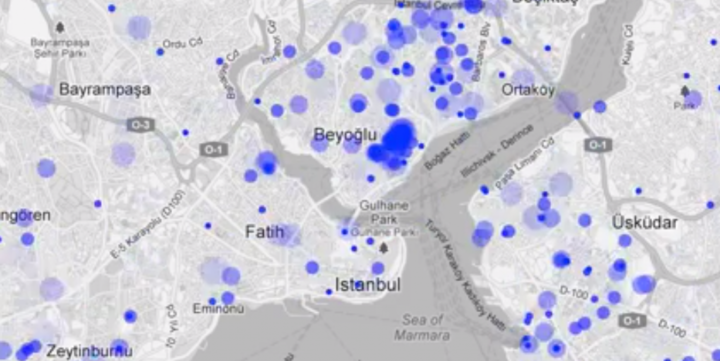
Another example: The Atlantic used geolocation to show the crucial influence of tweets during the recent Turkish protests and how fast those messages traveled the world.
_Image: Screenshot of mapping of tweets during the Turkish protest_
Gabriela Manuli, IJNet’s Spanish editor, is freelance journalist from Argentina. She has a master's degree in public policy and media from the Central European University.

