
The Rainforest Investigations Network (RIN) asked its 2022 Fellows about the innovative methodologies behind their impactful stories. Below is an abbreviated version of the full reporting guide (also available in Portuguese) published on the Pulitzer Center website:
When we started this investigation (first published on Intercept Brazil in Portuguese), we knew that the main driver of deforestation in the Brazilian Amazon was the land grabbing of non-designated public lands, which belong to federal or state governments and haven't been converted yet into Indigenous Land or Protected Areas.
Our hypothesis was that land grabbing is actually a very organized industry, which involves a lot of money and happens on a large scale. As our reporting developed, we decided to focus on the single largest deforestation in the Amazon.
Methodology
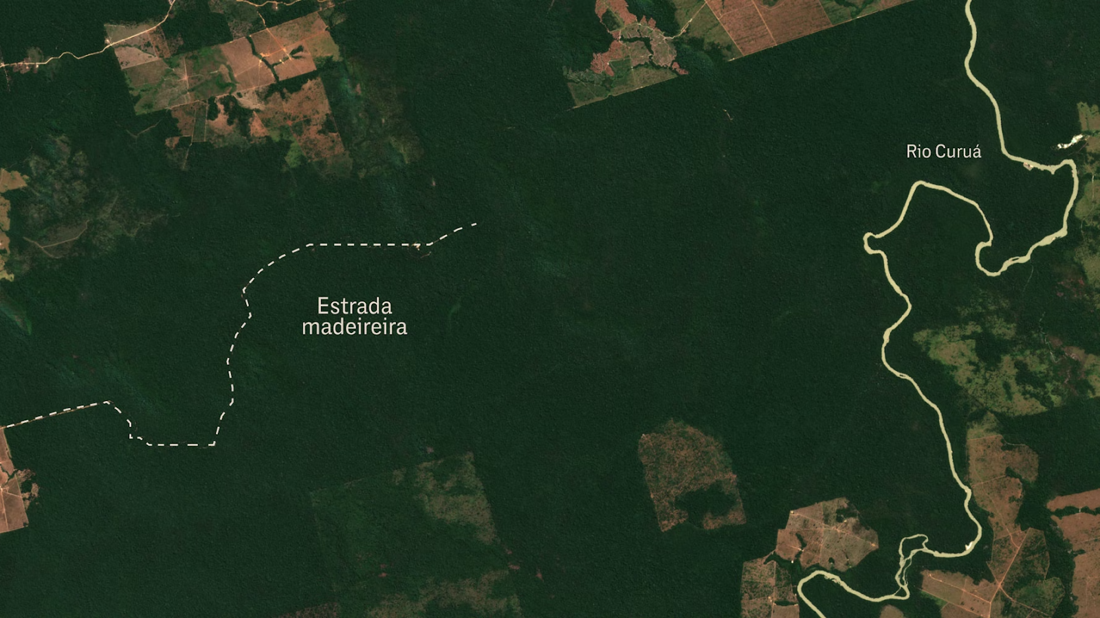
We used Mapbiomas Alerta to look for the largest deforestation registered and we found it: a 6,500-hectare deforestation in the South of Pará, Brazil.

We downloaded the map file (or polygon) of the deforestation, then used open-source geospatial software QGIS to cross-reference it with CNFP (federal government’s public forest registry) polygons. This allowed us to confirm that the deforestation happened inside a non-designated public land.

We decided to use this approach because we wanted to go after the professional land grabbers; the ones who have a lot of money. We knew the first thing a land grabber does is to clear the forest, and that the cost to deforest 1,000 hectares was around US$200,000.
What was unique in our approach is that we didn't want just to tell the story of the land grabbers, but of the land as well. The deforestation itself was one of our main characters.
So our investigation took two different paths. On one side, we worked to find out who was behind this deforestation. We overlapped Pará’s CAR (rural land registry document) polygons with the deforestation area, and found two CARs registered there, in the name of two men. We used both CAR and databases of Sigef, the land register data system of Incra, Brazil's land agency, to look for other properties in their names or in the names of their family members.

Then we downloaded deforestation data from Prodes, Brazil's official deforestation database, and overlapped it with the other CARs and Sigef's properties, to check if they were also deforested. We used data from the national environmental agency Ibama (publicly available here and here) and court files from both the federal court and Pará state court to check their history of environmental crimes. We used the company information website CruzaGrafos to see if they had companies in their names, and used GTAs (files that show cattle transport) to see if they were cattle ranchers and for whom they sold these cattle.
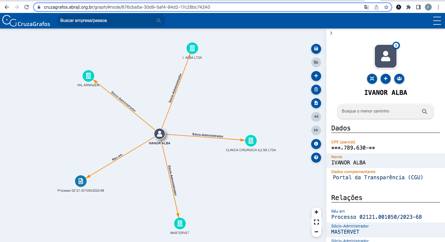
We used social media to see what these guys look like, what kind of life they have, what kind of work they had, and how important they were in their communities. After putting all this evidence together on a spreadsheet, we had enough elements to say for sure that one of the guys who registered the land in his name on CAR was probably a proxy. But the other one was from a family of local landowners, who produce soy and cattle and have political influence in the local community.
The second path was to tell the story of this land. Our technology partner, Earthrise Media, used high-resolution satellite imagery to show each step of the deforestation, from selective logging to large-scale deforestation and the use of fire. Through a court file opened in Pará after Semas (the Pará state environmental agency) fined the land grabbers for this deforestation, we also found out what kind of machinery they used to cut the forest down
– chainsaws and tractors. That is because the court file included a report made by Semas' employees once they got to the deforestation area, in which they described what they found on the site.
To locate this court file, we used the land grabber's name to look for court files in Digesto (paid court files database) and then located the right file on Pará's court website. With that information, we asked a lawyer to get us the whole lawsuit court file. (In Brazil, this can only be done by lawyers, and only if the case is not under secrecy.)
Putting all these pieces together and talking with local sources, we could estimate how much money they spent on the deforestation (US$2.5 million), and how much money they would make if they sell the land after that (US$25 million).
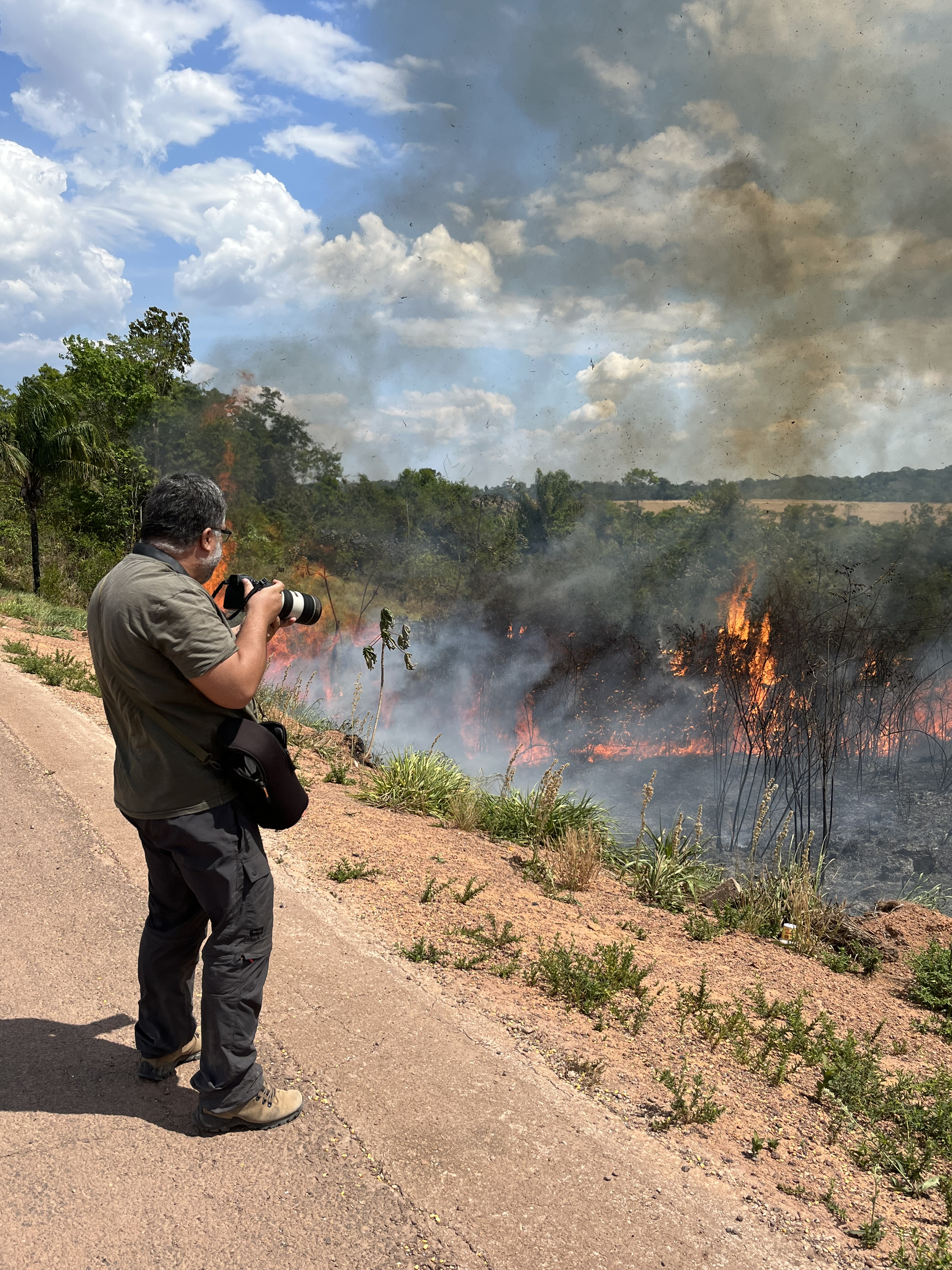
Once we had a lot of evidence, we went into the field to capture the atmosphere of that region (a community whose economy is affected by land grabbing, deforestation and illegal mining), to take pictures and to talk with some local sources.
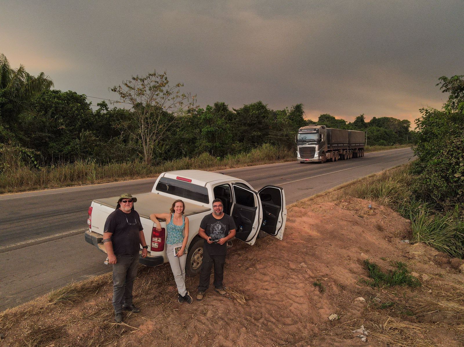
Credit: Fernanda Wenzel
Credit: Bruno Kelly
The main challenge was to construct the story of the characters and of the land, having few local sources and not being able to talk with many people nor get too close to the area once we were in the field due to safety concerns. What I learned, however, is that the more you spend looking for evidence and then cross-referencing this evidence, the more bulletproof your story is. But don't forget: you have to organize this evidence very well, otherwise you will be buried by information.
I also learned that, at some point, you have to stop doing office work and put your feet on the ground. No matter how hard it can be, it will always bring you a much more realistic view of the story, which you will be able to share with your reader.
Photo by Nathalia Segato on Unsplash.